Loading summary
Transcript72 lines
- [00:01]
A
With stays under $250 a night, VRBO makes it easy to celebrate sweater weather. You could book a cabin stay with.
- [00:08]
B
Leaf views for days or a brownstone in a city where festivals are just a walk away. Or a lakeside home with a fire.
- [00:15]
C
Pit for cozy nights with friends.
- [00:17]
A
Or if you're not a sweater person.
- [00:19]
C
We can call it corduroy weather. More flexible.
- [00:22]
B
And with stays under $250 a night.
- [00:25]
C
You can book a home that suits your exact needs.
- [00:28]
B
Book now@vrbo.com For 140 years, MultiCare has.
- [00:33]
A
Been in Washington prioritizing long term solutions, partnering with local communities and expanding access to care. Together, we're building a healthier future. Learn more@mycare.org arm.com.
- [00:56]
B
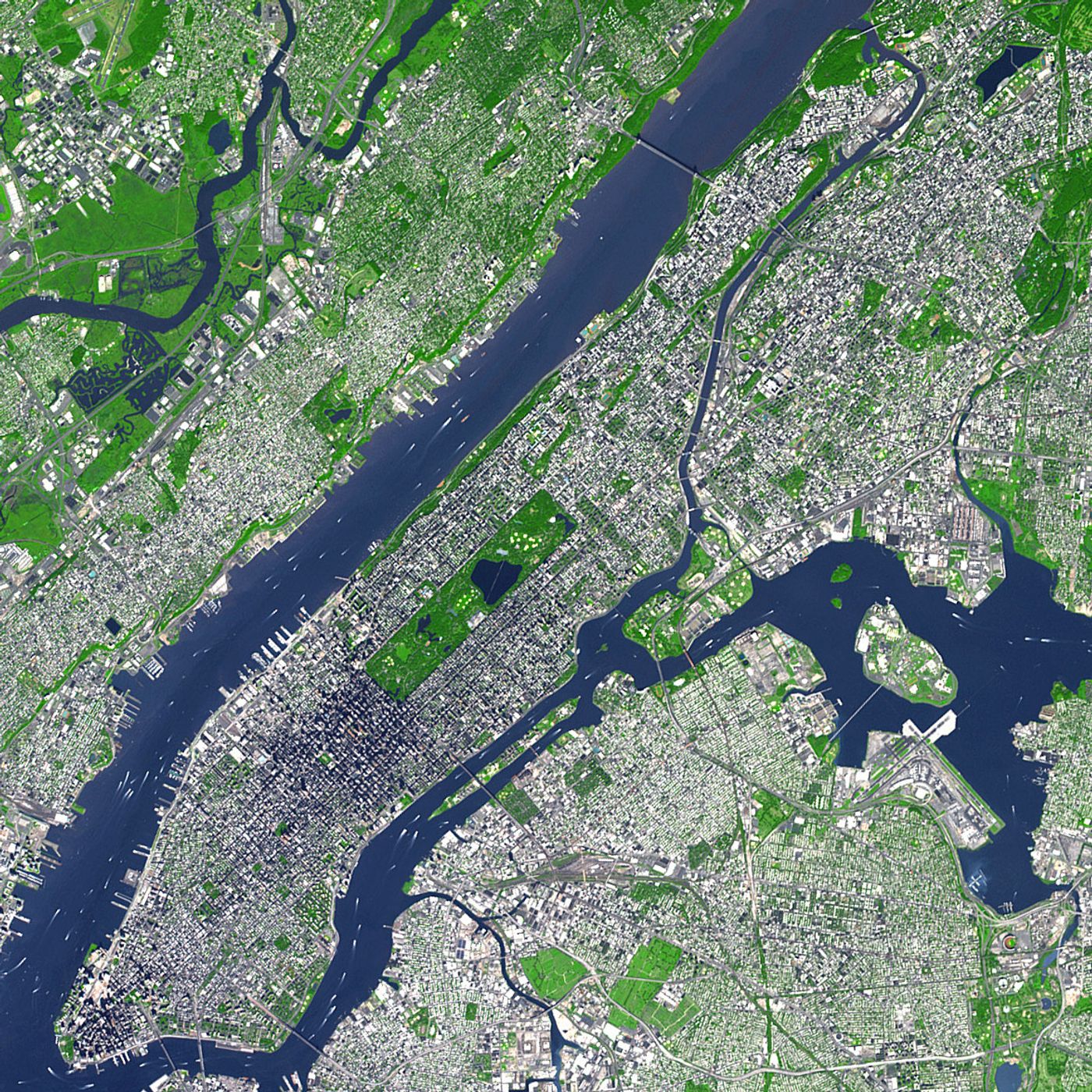
This is all of it. I'm Alison Stewart. We're live from the WNYC studios in soho. Thank you for spending part of your day with us. I am really grateful that you're here. On today's show, we'll speak with musician and music industry veteran Simon Raymond about his new memoir, In One Ear. We'll also talk about the recent reopening of the Studio Museum in Harlem. And we'll learn about the new documentary titled the Big Cheese. That's the plan. So let's get this started with a plan for a unified city map. Nearly two weeks ago, New Yorkers went to the polls and voted overwhelmingly in support of ballot proposal number five. 73% of voters were in favor of it. The proposal will put an end to the current practice of having each borough president maintain maps for each individual borough or why? Well, because that practice has led to about 8,000 individual paper maps across five boroughs containing data like street names, street widths, parkland, property lines, waterfront borders. You get the picture. Instead, one city agency will be tasked with taking in all this data to create and maintain a unified and digitized city map. One map to rule them all, if you will. Joining me to talk about what this might look like and how they might do it are two guests. Noel Hildalgo is the executive director of Baden nyc, a nonprofit civic technology group. He joins me in studio. It's nice to talk to you.
- [02:39]
A
Hello.
- [02:40]
B
And also Stephen Romolowski. Did I get your last name? Romuluski Romolewski, director of CUNY Mapping Service. He's joining us via Zoom. Nice to talk to you as well. Thank you, listeners. New York City voters have spoken and there's going to be an official government map. What do you want to see mapped? What do you hope to see? Hope a unified city map Will make easier. Give us a call or text us at 2124-3396-9221-2433. WNYC. Do you use a city data? How? Let us know. 2124-3396-9221-2433. WNYC. Let me put a couple of questions to both of you. We'll start with you. Noel, we'll start you in. You're in the studio. Why is the value of a single official city map? What is the value of it?
- [03:31]
A
I mean, the explicit value is that there are right now five counties in New York City. Each one of them tends to have a different practice because it's all controlled by borough presidents. Each borough president has one staff member. So in total, there's probably five people maintaining maps. On the other hand, DCP is the central organization that's required to maintain our city's parcel property data, city planning data, and they have many more resources at their disposal, hoping that it's actually a fusion between the two, between having borough presidents and city planning work together. So that way we can ensure that all proper information that is maintained at that county level does feed up to one centralized, unified data standard map. The old saying of if you can't measure it, you can't map it, you can't manage it still holds true in the 21st century. If we are looking at advances within artificial intelligence or any other types of analytical infrastructure, we need to have clean and accessible data. This is something that is a perpetual struggle across limited resources within city government, and we're really hoping for within Beta nyc is that we have an opportunity to streamline those resources, align those resources, and make sure that maps work for all New Yorkers, not just for the property developers that are out there.
- [04:54]
B
Stephen, what is the value of a single official city map?
- [04:59]
C
Well, I guess we'll find out because we, you know, it's still a question about how this will actually develop. You know, the ballot proposals is, as far as I understand, specifically about taking the paper maps that each of the topographical divisions or whatever in the borough president's offices manage and convert that to a digital map so they can more, in a more coordinated way, manage things like street naming and, you know, understanding the infrastructure patterns within each of the five boroughs and doing that now citywide in a more, in an easier way. But, you know, the. There's been a process over the past actually couple of decades to take information that various city agencies maintain and convert that to a digital format and to map that and map that in more or less coordinated ways. You know, a lot of agencies have their own digital mapping operations and there's all sorts of different efforts underway and there have been different efforts underway. So hopefully it will all work out for the best. We'll see.
- [06:19]
B
Let's take a call. This is Alan calling in from Brooklyn. Hi Alan, thank you for making the time to call all of it today.
- [06:27]
C
Good morning. Thank you. I worked with the former deputy Mayor John Zucchadia's law firm and Land Use Law back in the 1980s and often visited city planning and dealing with these maps. And I was good to see the expertise and experience of these staffs with their long history wiped out by a consolidation of the effort. If they go to digital format, they should maintain paper substrates for what ends up being digitized. And if there's ever a discrepancy between what's on the paper base map and what is put online, we should always be able to ensure that no one has manipulated a digital record, which seems to be so easy to do these days with all sorts of data.
- [07:11]
B
Thank you for your comment. I'm speaking with Noel Hildalgo, the executive director of the nonprofit civic technology group Beta nyc. And Steve Romuleski, he's the director of CUNY Mapping Service. We're talking about the digital map that New Yorkers recently voted overwhelmingly in favor of creating and how it might be used. And listeners, we want to hear from you. What do you want to see mapped on the city? What do you want to see on a city map? Give us a call. 212-433-969-22124 433 wnyc. Noel, what problem does a unified city map, what problem does it solve.
- [07:51]
A
From the most complicated perspective, but yet the most accessible one is understanding what's in our public space. Right now it's really easy to understand what's in the street because those big tech companies are sending cars with a lot of sensors down streets and they're able to scan those streets and are able to give us a pretty clear picture of more or less what's on our roads. But the more complicated picture is what's within the public realm when we're pedestrians where cars can't go. And so our parks, our sidewalks of the public, the public spaces where we are New Yorkers through and through, tends to be under mapped. And so the idea of making sure. And we have a program called Open Street Map that's built on OpenStreetMap. It's called mapping for Equity where we go out. And we teach New Yorkers how to map these under mapped locations. And what we tend to find that is that those places that are in lower socioeconomic communities tend to not be mapped. And yet when we go into the city data, there is that map data, but it hasn't been digitized. And so you go into your park and your park has that favorite park bench that's there. There's a good chance that that park bench doesn't exist on a publicly accessible map. It sits as an administrative data point, but not necessarily a place for you to know and to see on the map. And so having a unified helps us bring together all of the diverse resources that Steve was introducing in the same way that we've already unified New York City open data through the open data portal. So it clarifies that there needs to be one agency that's responsible for digitizing all of this information to ensure that it works for everybody. And so it's about the process. And we're really hoping that the process is an inclusive process and not like the first caller where it's a restrictive process and kind of like it holds back and only one organization has access to it.
- [09:49]
C
Stephen, if I may, could I comment on the first caller's question also just to point out. So the CUNY Mapping Service is a project of the center for Urban Research at the CUNY Graduate center. Cuny, the City University of New York is a big place. So just so people understand where this is. So the point about having paper maps as well as a digital map so there's some physical record as well as a digital record is interesting. You know, when I was in the mid-90s, I was a graduate student at Columbia University's Urban Planning Master's program. And one of the professors, part time professor, was from the City Planning Department and he was talking about zoning maps. And at the time the thinking that the City Planning department was that they would never ever, ever have a digital version of zoning maps because the zoning boundaries could be so easily manipulated and people would abuse it and blah blah, blah, blah, blah. And of course that's not a concern because there's the official data that's managed by the city agency, the agency of record, the authoritative entity. And they have the paper records and they have the digital records and people use now the City Planning department eventually did a 180 and did in fact make digital data that represents the zoning boundaries and the parcel boundaries publicly accessible. And I'm assuming I don't know this for certain, but I'm assuming They also have paper zoning maps. So there is something physical to fall back on in addition to the digital representations of it. But having that digital representation of the zoning boundaries or any other infrastructure resource in New York City is really helpful because then that makes it more easily accessible for people to view the information, to take that digital data and incorporate it into other applications. So you can compare zoning with whatever else you want to compare it with. Could be land use, could be, you know, public toilets, could be, you know, anything. And it's just, it just makes it that much more usable and meaningful. And by making it accessible like that, it increases the value of the information tremendously. So that's why. So I think that point about having the physical record as well as the digital record is really important. But I think having the digital record and making that accessible, freely accessible, is a really helpful thing.
- [12:40]
A
Can I throw in something that's really funny is that mapmakers, not to put a negative light on them, but mapmakers have historically put in inaccuracies to more or less fingerprint their maps.
- [12:52]
B
Really?
- [12:53]
A
Oh yeah.
- [12:56]
B
Pesky cartographers.
- [12:57]
A
Yeah, I know that the block that I grew up on, the road, the name of the road extended a little bit longer and it was named incorrectly with a different spelling than the actual name of the road. And so like if we're going to be talking about information and making sure that information is accurate and kind of is preserved, there are ways to manipulate information paper or digitally. And agreeing with Steve is that the idea is to make sure that all of this information is accessible. And when we increase accessibility, we're able to increase accountability. And that's part of the progressive era mindset. And this is the continuation of those values into the 21st century.
- [13:39]
B
We've got a whole bunch of texts here, updated FEMA and depth flood risk maps now that NYC is getting more and more rain as climate warms. That's what I want. Another said street width as it applies to changing two way streets originally designed for model T Fords that are too narrow for SUVs. Another says a consolidation of utility, power, sewer, water supply, cable, telephone, all on one map. That's what I would like to see. Someone who couldn't stay on the line did have an interesting question. The question was going to a digital map. Could it be, could it be accessed? Is that what it says?
- [14:20]
A
Kate?
- [14:22]
B
Mark was, he was concerned, could it be hacked? Could the digital map be hacked? What do you think?
- [14:31]
A
I mean anything can be hacked. Locks, you know, no lock is perfectly lockable, right? Like locks are all about just preventing people from getting into something very quickly. All information can be misrepresented. The idea and the data practices that our tax dollars fund and support and are really, really thought through. There are really intelligent civil servants who are really passionate about these issues. They want to make sure that the information is accurately displayed. And we have fought at Beta NYC to ensure that when we see misinformation within these data systems that there's actual opportunities to either call, email or suggest a form. So nothing is unhackable, everything is hackable. But the point is making sure that there's platforms to correct inaccurate.
- [15:27]
B
Stephen, could you give an example for someone who's trying to figure out why is this a big deal? Can you point to a point in the past where it was clear that the mapping status quo, it really wasn't working?
- [15:40]
C
Well, there's an example now where it's not working. There's an effort underway to try to better understand underground infrastructure in New York City. And underground infrastructure means everything from sewer pipes to water pipes to telecommunications, conduits, subway routes, all sorts of things, tunnels. And what happens now? Maybe it's changed since I last talked to people about this a few years ago, but people come to a location where there needs to be the pothole repaired or if some dig happens, needs to happen in a street, and all of the different utilities come, all of the different city agencies come and they all show up with their paper maps and they compare notes and you know, it sounds, these days, it sounds kind of crazy, but that's been happening for decades. And having a digital representation, so it's a little different than the above ground infrastructure, this is below ground. But having a digital representation of that, that all of those entities can access directly and at the same time and in a coordinated, consistent way with reliable data would be extremely helpful, very efficient and a huge improvement over the current process. So I mean, that's an example not from the past, that's happening now.
- [17:11]
B
We are talking about the digital map that New Yorkers recently voted overwhelmingly in favor of creating. We'll have more after a quick break. This is all of it.
- [17:21]
A
Our common Nature is a musical journey with Yo Yo Ma and me, Ana Gonzalez, through this complicated country.
- [17:28]
B
We go into caves, onto boats and.
- [17:30]
C
Up mountain trails to meet people, hear their stories, their poetry, and of course, play some music, all to reconnect to nature and get closer to the things we're missing.
- [17:42]
A
Listen to a single special one hour broadcast of our common nature on the radio tomorrow night at 9 on WNYC. WNYC received support from the Studio Museum in Harlem where black art lives.
- [17:56]
B
Now open to the public at 144.
- [17:59]
A
W. 125th St.more@studio museum.org City Harvest, who are on the road every day rescuing 77 million pounds of nutritious food a year for New Yorkers in need.
- [18:10]
B
Transforming surplus food into sustenance and sustainability.
- [18:14]
A
That's how they feed Good. More@CityHarvest.org the New York Phil Agustin Hadlesch.
- [18:20]
B
Performs Barber's Violin Concerto and Dimas lebodiniuk conducts Sibelius Second Symphony November 20th, 21st and 22nd at David Geffen Hall. Tickets@nyphil.org. You're listening to all of it on wnyc. I'm Alison Stewart. I'm speaking with Noel Hildago, the executive director of the nonprofit civic tech group Beta nyc, and Steam Romuleski, the director of CUNY Mapping Service. We're talking about the new digital map that New Yorkers recently voted overwhelmingly in favor of creating. Listeners, we'd like to hear from you. What do you want to see mapped out on the city? Give us a call, 212-433-9692. Let's talk to Bill, who's called in from Greenwich Village. Hi, Bill.
- [19:14]
C
Hi there, Allison. My question is Stephen Nessen, the NYC's transportation reporter, visited a special map room in the subway system. When there is a stall train, a specialist goes through, excuse me, paper maps to reroute other trains past this stalled train. Will this system also be included in the digital maps?
- [19:46]
B
Is that something that either of you can answer or is that grabs?
- [19:49]
C
I don't think it will. It may eventually. But I think what you're referring to is how the mta, through their New York City Transit subdivision that manages the subways, handles their infrastructure and what happens when a train is stalled. And I think the ballot proposal that we're talking about is specifically for the taking the paper maps that each of the borough president's offices had managed separately and again on paper and converting that to a unified, coordinated digital map. So I don't think that directly involves subway routes, but it, you know, I think part of the point of this is once there is this more coordinated digital representation of all of the city's infrastructure, it could be extended and it could be added and added to and enhanced to incorporate all sorts of other things that you can then visualize and analyze in a coordinated way.
- [20:52]
A
One of the things that this ballot proposal does is that it unifies the efforts. So right now, the Five counties that are comprised of New York City are each individually responsible for street names and numbers. And then they each one of those counties, that is the borough presidents have to then coordinate with the postmaster of each county and make sure that that information is all together and unified. And so there's been breakdowns in communication between each postmaster and borough president between that data and information. And something that we worked on at Beta NYC was actually an address assignment datab that helped digitize these processes. So that way, when the borough president's cartography office assigned that borough block and lot number and gave that building an address number and a street name and unified those things, it would be simple to hand it off to the postmaster of that county. So that way that information and mail can be delivered appropriately. If you ever had any problem, if you lived in a new building and you had problems with your mail being delivered, you have experienced this explicit issue of essentially mail not being properly routed. And the more people that we get in New York City, we're going to have more zip codes, which is really based upon how mail is being delivered. And so we need to ensure the longevity of New York City's postal system, address system is unified, and we live in this glorious city where all of these things can happen if we just invest and unify those efforts. And that's what we really voted on, is to make sure that DCP has the ability to, to bring everybody together. And it's not charter mandated as a fractured process.
- [22:32]
B
This text said, I voted yes. I'd like some way for New Yorkers to challenge data. The information on rent stabilized apartments is inaccurate in city data because the landlords do not report reliable data to city and state agencies. Someone else is wondering, would a map make it easier for ICE or other government agencies to be able to locate people? Kind of like Big Brother being able to track anyone or, or anything. Talk to Chris in Brooklyn. Hi Chris, thanks for calling, all of it.
- [23:04]
A
Hi Allison, thanks so much. I had a little bit of a.
- [23:08]
C
Similar question to one of the previous callers, but the question about kind of tracking and ICE enforcement is a little bit related as well.
- [23:17]
A
I think the ballot proposal language really kind of indicated that it was more of a matter of just rounding up and kind of unifying data that exists already physically. But I had a question about, you.
- [23:29]
C
Know, does this then become kind of a pretense for additional surveillance and mapping once that existing data is rounded up? You know, could this kind of be it become a pretense for bad actors to potentially surveil New York citizens.
- [23:46]
B
Steve, I'm going to ask you that because the language around the proposal, it was sort of open to interpretation.
- [23:53]
C
So it's. I mean, that is definitely a concern. The specific aspect of the or the topic of the ballot proposal is really about street naming and data that the borough president's offices maintain on infrastructure like that doesn't have anything to do with people. Doesn't have anything to do with where people congregate. And, you know, as Noel said, any data can be. Digital data can be hacked and manipulated. And the question is if there are enough eyes on that data separate from whoever might be trying to hack it or manipulate it, to correct it and point out, well, no, what they're doing is wrong, that helps ensure that that type of thing doesn't happen. But I think one thing to point out or to caution, I guess, with any type of digital data is because it is easier to change, and it is. That does make it easier to modify things, that there definitely needs to be more deliberation over what changes might happen. You know, for example, I talked to people and in Queens who really like the hyphenated addresses in Queens because it helps them navigate and understand. And they've mentioned to me, well, is this something that's going to do away with the hyphenated address system? And, you know, again, it's a question of how the process unfolds. And it might be easier to do that with a digital mapping system, but hopefully there's enough deliberation over any kind of change that ensures that, you know, enough voices are heard to say, minimize changes or only allow changes that are really widely acceptable.
- [25:44]
A
I would like to add, we currently have a federal government that doesn't follow the law. What we saw at the very beginning of this new federal administration was the erosion of privacy and the separation of data sets. And when Elon Musk got his hands on all of the data and started throwing it around and some of that ended up on the dark Web, I mean, it started unifying data, that there were laws very specific to separate and to ensure that privacy and certain pieces of information wouldn't be crosswalked. Now, the funny thing is that while we had those protections within the federal government, we still have those protections at the state and the city level. You know, that's data that's held under New York State law and New York City law through the Freedom of Information act and data privacy laws. But those laws don't necessarily exist to commercial entities and commercial vendors. And so there's a huge opportunity to Ensure that New Yorker's privacy is protected at the state level. So that way, data brokers aren't buying and sucking up our Facebook and metadata, our browsing habits. You know, like, every time that you browse the Internet on your phone or at home, there's a data point that's created, and your Internet service provider has an opportunity to then sell that data to other entities and to actually profit off of your browsing habits. That is, the information that's being used to violate our privacy and to compromise our understanding of what it is to, you know, look at information discreetly. And when you start crosswalking, all of that information, which is freely available for the right buyer, that's when we start seeing the real privacy violations. And that's where the real concerns happen. I mean, anytime that you walk out the door with your cell phone, I mean, heck, you even have the phone in your pocket at home, it's creating a data point and telling you where you are. So we need governments that actually follow the law, and then we also need stronger laws to ensure that our privacy and information protected within the 21st century.
- [27:44]
B
Let's talk to Olivia. Hi, Olivia, thank you for making the time to call. All of it. You're on the air.
- [27:50]
C
Hi. I think it actually ties into what your guest was just saying, that I.
- [27:55]
A
Actually think there's a lot of cause.
- [27:57]
B
For optimism about this considering the election of Zoran Mandani.
- [28:00]
C
I mean, he ran his campaign on.
- [28:03]
B
Making the city a better place to.
- [28:04]
C
Live and sort of like an emphasis on civic excellence. And I think there are a lot of ways that this map can sort of lend itself towards the people who want to do those things, having the information to be able to get it done. So I guess I'm sort of optimistic that the incoming administration will have an eye towards, you know, protecting privacy and making sure that the kinds of data.
- [28:28]
A
That'S collected and the ways that it's.
- [28:30]
C
Used are sort of for the people instead of for the corporate interest, for the city, instead of for people's personal pocketbooks.
- [28:40]
A
I didn't mean to make an alliteration.
- [28:41]
C
There, but.
- [28:44]
B
Thank you for calling in. Steve, what would success look like when this is accomplished?
- [28:51]
C
Well, I think success would be a digital map of the street naming system that would be coordinated among each of the borough president's offices and perhaps through the city planning department or some other central city agency. And it also would be maybe small but important examples of people being able to work together better. You know, for example, there's a provision in the New York City charter that says that for service delivery in New York City, service districts need to be coterminous to follow the boundaries of community boards, for example, that already exist and probably need to be redrawn because there have been such population changes since the last time the community boundaries were drawn. But, you know, this provision is not really followed and there's all sorts of service delivery all over the place using different types of boundaries and different types of mechanisms. And so maybe this would be a way of making that easier to follow and, and easier also to have a conversation around these types of things where again, if more people have access to the information, it's easier for more people to weigh in and to talk about a common framework. So I think that would be a success.
- [30:13]
A
And just to, Sorry, just to point a light at what Stephen just described is that Beta NYC created a tool because we found this exact problem is that we have all of these political and administrative districts that overlap and they're not succinct. So we ended up creating a tool called Boundaries Map Boundaries Beta nyc which illuminates all of the political and administrative boundaries.
- [30:36]
B
I want to ask you before we wrap this week is OpenStreetMap Geography Awareness Week. What is happening this week?
- [30:47]
A
OSM is the wiki of maps. It is the coolest map you'll ever be able to put your hands on because it is the way that you can engage with a bunch of geonerds and really to make your community represented in the map. It runs a very similar methodology as Wikipedia, so there's a very concrete way of adding information. OSM GeoWeek is where community members host in person and virtual events to showcase the power of crowdsource mapping and we invite new mappers to the fold. If you take a look at OpenStreetMap US, you will find out all of the events that are happening. Or you can search OSM geoweek that's happening this week. And then at the end of March, New York City has a very special week that's dedicated to open data that's filled with maps. It's called Open Open Data Week where we get the city's data nerds and we get the city's cartographer nerds and the activist organizations all coming together. We get thousands of people to come celebrate data and information and maps and the process between it all. And then we host a closing party at CUNY Law School that's called NYC School of Data. So that's happening in March this week. Check out OSM GeoWeek and then OpenStreetMap I mean, excuse me, Open Data Week at the end of March.
- [32:08]
B
Noel Hidalgo and Steven Romuleski, thank you so much for joining us and thanks to all our callers who called in.
- [32:14]
C
Thank you, thank you. Businesses that are selling through the roof like Untuck it make selling and for shoppers, buying simple with Shopify home of the number one checkout on the planet and with Shop Pay you can boost conversions up to 50%. Businesses that sell more sell on Shopify. Upgrade your business and get the same checkout Untuck it uses. Sign up for your $1 per month trial period at shopify.com podcastfree all lowercase go to shopify.com podcastfree to upgrade your selling.
- [32:43]
B
Today NYC now delivers breaking news, top headlines and in depth coverage from WNYC and Gothamist every morning, midday and evening. By sponsoring our programming, you'll reach a community of passionate listeners in an uncluttered audio experience. Visit sponsorship.wnyc.org to learn more.