Podcast
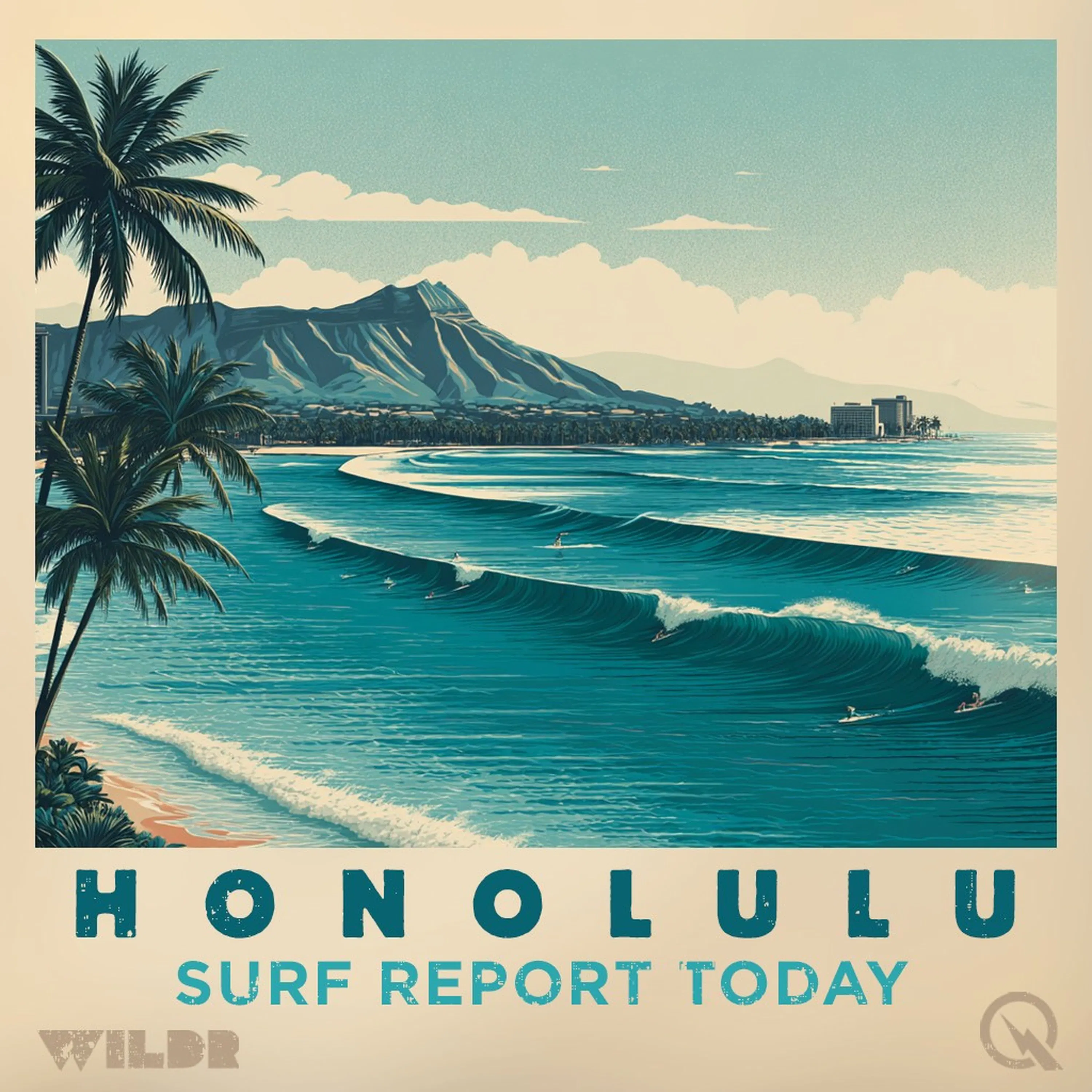
Surf Report for Honolulu Hawaii
Hosted by Inception Point AI · EN
Honolulu Hawaii Surf ReportScore the best waves on Oahu's South Shore with your AI surf advisor!
The "Honolulu Hawaii Surf Report" is your inside track to legendary surf spots like Waikiki, Ala Moana, and Diamond Head. Harnessing the power of AI to analyze National Weather Service data, this podcast gives you everything you need to know about the wave conditions in Honolulu.
What's inside each episode:
- Essential Wave Info: Wave height, swell direction and period, wind speed and direction, and water temperature reports.
- Focus on Oahu's South Shore: We'll highlight the impact on iconic breaks with recommendations for different skill levels.
- The North Shore Watch (Seasonal): Get updates on when the big winter swells hit Oahu's North Shore, including insights about when it might be manageable for experienced surfers.
- Island Vibes: Stay connected to the Hawaiian surf culture with potential updates on local events, surf contests, and the unique energy of the Honolulu surf scene.
- Future Expansion: Community Connection: We aim to integrate a network of local surfers and shops to give real-time observations and inside tips.
Who benefits most from the "Honolulu Hawaii Surf Report":
- Oahu Residents: Get daily surf intel customized for your home breaks.
- Hawaii Visitors: Plan your surf adventure with an understanding of what the waves will be like during your stay.
- Dreamers & Wave Lovers: Stay connected to the pulse of surf in one of the world's most iconic destinations.
Our AI-powered approach streamlines your surf session planning.
Get stoked! Subscribe to the "Honolulu Hawaii Surf Report" and make the most of every swell!
This content was created in partnership and with the help of Artificial Intelligence AI.
80episodes
Episodes
Newest firstAll episodes
Hawaii Surf Forecast South Swell Four to Six Feet Sunday into Monday June 21st 22nd
4w ago00:03:19Tap to summarizeGood afternoon, this is your Hawaii surf forecast for Sunday evening into Monday, June 21st through the 22nd. The big story this week is south-facing shores absolutely lighting up. Multiple overlapping swells ranging from small to long period are queuing up and heading our way, keeping south-facing beaches consistently elevated through next weekend. If you're chasing waves on the south side, you'll want to lock in these conditions while they last. Let's break down what's happening by island, starting with Kauai. Tonight and Monday morning, north-facing shores will stay small at zero to two feet, while west-facing beaches hold a modest one to three feet. South-facing beaches are the real deal, delivering four to six feet tonight and through Monday morning, dropping just slightly to three to five feet by Monday afternoon. East-facing shores remain calm at one to three feet. Winds will be light out of the east tonight at five to ten mph, shifting to northeast around fifteen mph Monday afternoon. Lows dip into the lower seventies with mostly clear skies and just isolated showers. Moving to Oahu, the pattern is remarkably similar. North and east-facing shores stay small, while that south swell continues to paint a beautiful picture with four to six feet tonight and Monday morning, easing to three to five feet by afternoon. West-facing beaches steady at one to three feet throughout. Monday brings mostly sunny conditions with highs in the lower eighties, though heads up on the UV index ramping up to extreme levels. Winds pick up from the east at ten to fifteen mph. Maui's looking good with the same south-facing swell story. You're looking at four to six feet tonight and Monday morning on south exposures, tapering to three to five feet Monday afternoon. North and west-facing shores remain modest. Conditions stay sunny with highs in the mid-eighties and east winds ten to fifteen mph. For the Big Island windward and southeast side, south-facing beaches dominate with four to six feet tonight and Monday morning, dropping to three to five feet by afternoon. North and east-facing shores stay small. Expect mostly sunny conditions tonight turning mostly cloudy with scattered showers. Monday improves with mostly sunny skies and north winds five to ten mph. The leeward side of the Big Island rounds out the forecast with similar south-facing swell action at four to six feet tonight and Monday morning, easing to three to five feet Monday afternoon. West-facing beaches hold one to three feet. Mostly sunny Monday with highs in the mid-eighties and light winds becoming southwest in the afternoon. One important note: as trade winds strengthen later this week, east-facing shores will begin to see increased swell activity, so keep an eye on those forecasts for updates. Remember, swimmers should exercise caution and try to get in the water near lifeguarded beaches. Rip currents will be present in or near the surf zone, and their strength increases with surf size. For detailed beach hazard and safety information at individual locations, visit hawaiibeachsafety.com. The bottom line: if you're a south swell hunter, this is your window. Get out and enjoy these elevated conditions while they're here. For more http://www.quietplease.ai Get the best deals https://amzn.to/3ODvOta
Transcribe →Hawaii Surf Forecast Saturday June 20 to Sunday June 21 South Swell Peak Conditions
Jun 2100:04:07Tap to summarizeGood afternoon, this is your Hawaii Surf Forecast for Saturday, June twentieth through Sunday, June twenty-first. A small medium-period south swell continues to fade tonight, but a new long-period south swell is peaking overnight that should keep things interesting through the evening hours. By Sunday, we'll see that south and west-facing surf beginning to diminish as this system moves through. Looking ahead, additional medium to long period south and southeast swells are expected through the middle of next week, which will maintain our surf heights right around those seasonal averages we're used to seeing this time of year. North-facing shores are going to be pretty quiet, with tiny surf expected to prevail through most of the coming week. We're just not getting much short-period energy reaching the islands from the north and northwest. However, keep an eye on east-facing shores because as the trade winds increase next week, expect to see that surf trending upwards. Let's break down the islands, starting with Kauai. Tonight we're looking at north-facing shores with zero to two foot surf, while west-facing shores are more active at three to five feet. South-facing shores are slightly bigger at four to six feet, and east-facing shores will see one to three feet. Sunday morning brings similar conditions before those west and south-facing shores start dropping through the afternoon. Winds tonight will be light, east at five to ten miles per hour, with lows in the mid seventies and mostly isolated showers. Sunday looks sunny with those winds increasing to the northeast around fifteen miles per hour in the afternoon. Highs will reach the upper eighties. Over on Oahu, tonight's conditions are nearly identical to Kauai with zero to two foot north-facing surf, three to five feet on the west, four to six feet on the south, and one to three feet on the east. We'll have mostly clear skies with east winds at ten to fifteen miles per hour. Low temperatures settling in the mid seventies. Sunday morning maintains similar heights before the afternoon fade. Expect mostly sunny skies with an extreme UV index, so definitely get that sunscreen on. Winds remain from the east at ten to fifteen miles per hour with highs in the mid eighties. Moving to Maui, north-facing shores tonight show zero to two feet while west-facing drops slightly to two to four feet. South-facing is solid at four to six feet and east-facing one to three feet. Winds start at east ten to fifteen miles per hour then diminish to around five after midnight. Sunday brings sunny conditions with northeast winds at ten to fifteen miles per hour. Highs in the mid eighties with that similar pattern of afternoon decline on west and south-facing shores. The Big Island's windward and southeast shores will see zero to two foot north-facing surf tonight, one to three feet on the east, and five to seven feet on the south, making that the most active zone. Conditions stay mostly the same Sunday morning with that afternoon pullback. We'll have scattered showers, particularly tonight and Sunday morning. Lows in the lower seventies with light north winds tonight, becoming northeast around five to ten miles per hour Sunday. Highs in the lower eighties. On the leeward side of the Big Island, west-facing shores show three to five feet tonight with south-facing at four to six feet. Both shores ease down Sunday afternoon. We're looking at isolated showers with lows in the lower seventies. Winds tonight start light and variable around five miles per hour from the west before becoming north. Sunday brings mostly sunny skies with light southwest winds and highs in the upper eighties. Across all islands, remember that rip currents will be present in or near the surf zone, with strength increasing as surf size increases. Swimmers are urged to exercise caution at all times and enter the water near a lifeguard. For the latest beach hazard and safety information at individual beaches, visit hawaiibeachsafety.com. Stay safe out there and enjoy the waves. For more http://www.quietplease.ai Get the best deals https://amzn.to/3ODvOta
Transcribe →Hawaii Surf Forecast Friday Saturday South Swell Fading New Swells Arriving Early Next Week
Jun 2000:03:48Tap to summarizeGood afternoon, I'm here with your Hawaii surf forecast for Friday through Saturday, brought to you by the National Weather Service in Honolulu. Let's start with what we're expecting across the islands. A small to medium period south swell will continue fading into Saturday, causing surf along south and west-facing shores to drop just a notch. But don't worry, relief is on the way. A series of small to long-period south and southeast swells will move in Saturday into early next week, pushing surf heights right back up to where they should be this time of year. Now, if you're a north shore enthusiast, I've got some challenging news. Tiny surf will dominate north-facing shores throughout most of the coming week. We're only seeing limited short-period energy arriving from the north, so patience will definitely be a virtue if that's your preferred break. East-facing shores are currently running below average thanks to lighter than normal trade winds through the weekend. However, we're expecting that to change early next week when trade winds increase upstream and across the region, bringing east shore surf back to life. Looking at specific conditions for tonight across all our islands, expect mostly partly cloudy skies with isolated showers and east winds staying light at five to fifteen miles per hour depending on your location. Temperatures will settle into the mid seventies. Overnight low tides vary by location but will give you some excellent beach walking opportunities in the early morning hours. Saturday is shaping up nicely with sunny to mostly sunny conditions and only isolated showers in the forecast. High temperatures will climb into the mid to upper eighties. East winds will remain around ten to fifteen miles per hour, increasing slightly in the afternoon on some islands. The UV index will reach extreme levels, so make sure you're protecting your skin out there. Across Kauai, tonight brings north-facing shores two feet or less while south-facing breaks will see four to six feet. West-facing shores are looking at two to four feet and east-facing beaches one to three feet. Saturday morning, expect that slight fade with south-facing shores dropping to three to five feet. By Saturday afternoon, the swell will back up slightly with south-facing shores returning to four to six feet. Oahu will see similar patterns with north-facing shores staying tiny at zero to two feet and south-facing breaks ranging from four to six feet tonight. West-facing shores will hold two to four feet while east-facing coasts settle at one to three feet. Saturday will bring that expected fade and recovery pattern we mentioned. Maui's forecast mirrors much of what we're seeing across the chain, with south-facing shores providing the most consistent action at four to six feet tonight, fading to three to five feet Saturday morning, then rebuilding Saturday afternoon. North-facing shores will remain minimal throughout. The Big Island's windward and southeast side will see south-facing breaks offering the most activity at four to six feet tonight, with potential for five to seven foot faces Saturday afternoon as new swell fills in. East-facing shores will stay in the one to three foot range while north-facing breaks remain small. On the Big Island's leeward side, south-facing shores will offer four to six feet tonight with similar patterns for Saturday. West-facing breaks will maintain consistent two to four foot surf throughout the forecast period. Bottom line: if you're chasing south or west-facing breaks, tonight and tomorrow will give you solid, workable conditions before the new swell arrives to reinvigorate things. East shore surfers should monitor conditions closely as trade winds are expected to pick up early next week. Stay hydrated, watch for rip currents, and always check the beach hazard safety information at hawaiibeachsafety.com. For more http://www.quietplease.ai Get the best deals https://amzn.to/3ODvOta
Transcribe →Hawaii Surf Forecast Thursday Friday High Surf Advisory South Swell Peaks Seven to Ten Foot Waves All Islands
Jun 1900:03:15Tap to summarizeGood afternoon surfers, this is your Hawaii Surf Forecast for Thursday evening through Friday. A moderate long period south swell is absolutely peaking right now at advisory levels, and we've got High Surf Advisories in effect for all south facing shores through early Friday morning. Let's break down what's happening across the islands. On Kauai, south facing breaks are seeing seven to ten foot faces this evening, with six to eight foot waves expected tomorrow morning before dropping to five to seven by midday. West facing shores are holding solid at five to seven feet tonight. North and east shores are staying small at one to three feet, pretty typical for this time of year. Tonight expect partly cloudy skies until midnight, then clearing out with isolated showers possible. Low temperatures dipping into the lower seventies with light southeast winds around five miles per hour. Moving to Oahu, the south swell is equally impressive with the same seven to ten foot faces on south facing shores this evening. West facing breaks are also pumping at five to seven feet. The forecast looks nearly identical to Kauai as this swell moves through, so if you're chasing south swells, get out there sooner rather than later. Friday looks mostly sunny and warm with highs in the mid eighties and east winds picking up to ten to fifteen miles per hour. Maui is seeing similar conditions with seven to ten foot faces on south shores tonight and a slight decrease expected by tomorrow. West facing shores are a tick smaller at four to six feet. East and north facing breaks remain tiny at one to three feet. Friday stays mostly sunny with isolated showers and mid-eighties temperatures. Over on the Big Island, both windward and leeward areas are experiencing that same quality south swell, with leeward and windward south shores showing seven to ten foot faces. East facing shores remain minimal at one to three feet. Leeward west facing breaks are four to six feet, which should provide some fun alternatives if you're looking to avoid the crowds on the main south swell zones. Here's the important part to plan ahead. This swell gradually fades late tonight into the weekend, and by Friday afternoon we're expecting surf to drop below advisory levels. However, don't worry about it getting too small. A series of smaller south to southwest swells will fill in by Sunday and carry into the first half of next week, keeping conditions near seasonal averages throughout the seven day period. North and east facing shores will remain tiny through most of the coming week, but we're expecting a slight pickup in east shore surf around next Tuesday or Wednesday as trade winds build across the region. Tonight stays partly cloudy with scattered to isolated showers across the islands, lows in the lower to mid seventies, and light winds. Tomorrow, Juneteenth, will be mostly sunny with isolated to scattered showers, highs in the mid to upper eighties, and east winds ranging from five to fifteen miles per hour depending on location. Get out there and enjoy this south swell while it lasts. Remember to watch for rip currents and swim near lifeguards. Check hawaiibeachsafety.com for the latest beach hazard information at your favorite breaks. For more http://www.quietplease.ai Get the best deals https://amzn.to/3ODvOta
Transcribe →Hawaii Surf Forecast Thursday High Surf Advisory Territory South Facing Shores Six to Ten Feet Waves
Jun 1800:02:09Tap to summarizeGood evening. Here's your Hawaii surf forecast for Wednesday night into Thursday. A series of southern hemisphere swells continues to march toward the islands, though nothing like the massive surf we saw recently. The current south swell is winding down slowly through tonight, but don't pack away your board just yet. A new south-southwest swell is moving in overnight and will peak Thursday, bringing surf right up to High Surf Advisory territory at around 10 feet on south-facing shores. It's not quite advisory level, but it's definitely worth paying attention to. If you're heading out Thursday, here's what you're looking at across the islands. South-facing breaks will be firing with six to eight feet in the morning, ramping up to seven to ten feet by afternoon. West-facing shores will see similar energy, four to six feet in the morning, building to five to seven feet by the afternoon. It'll be a solid day to be in the water if those south-southwest angles work for your local breaks. North and east shores will remain small and choppy, hovering in the one to three foot range, so save those for another day. Looking ahead, this swell will start declining Friday, but don't worry about it going flat. A series of smaller south-southwest pulses will keep conditions near seasonal average through the weekend and into early next week. Come Tuesday or Wednesday, we'll see a slight uptick in east shore surf as trade winds build back up across the region. Weather-wise, expect mostly sunny skies Thursday with scattered showers and east winds light to moderate at five to ten miles per hour. Highs will be in the mid to upper eighties depending on your location. Sunrise is around 5:45 to 5:54 AM, sunset around 7:01 to 7:23 PM, giving you plenty of daylight to work with. One final reminder: rip currents will be present in the surf zone, and they'll get stronger as the surf picks up. Always swim near a lifeguard and exercise caution when paddling out in bigger waves. For more http://www.quietplease.ai Get the best deals https://amzn.to/3ODvOta
Transcribe →Hawaii High Surf Advisory South Shores Seven to Ten Feet Tuesday, New Swell Wednesday Thursday
Jun 1700:02:25Tap to summarizeGood afternoon, this is your Hawaii surf zone forecast for Tuesday evening through Wednesday, presented by the National Weather Service in Honolulu. We're tracking a significant south southwest swell that's been delivering warning level surf across the islands this week. The good news? It's starting to fade, but not before we see one more quality day of waves. A High Surf Advisory remains in effect through tonight for all south facing shores statewide. We're looking at impressive seven to ten foot faces on the south side, particularly along Kauai, Oahu, Maui, and the Big Island. If you've been itching to paddle out on the south shores, tonight is your last chance before conditions drop. Here's what's happening overnight. Expect partly cloudy skies with temperatures dipping into the lower seventies. East winds will stay light at five to ten miles per hour, making for fairly comfortable conditions. North facing shores will remain small at one to three feet, while west facing breaks will hold solid three to six foot sets. Come Wednesday, the large swell will continue its decline. South facing shores will drop into that six to eight foot range, which means the High Surf Advisory will expire. We're expecting mostly sunny skies with isolated showers, highs in the mid eighties, and those same light east winds. However, don't pack away your board just yet. Here's where it gets interesting. Another moderate, long period south southwest swell is expected to move in Wednesday night into Thursday and could potentially push south facing shores right back up to advisory levels. This new energy will gradually fade through Friday and into the weekend. Meanwhile, north and east facing shores will remain relatively quiet throughout the entire forecast period. East facing breaks will stay below average as trade winds ease toward the end of the week, while north shores will stay flat to tiny. Conditions will be warm across all islands with temperatures in the lower to mid eighties and that persistent light east wind pattern. Remember, rip currents will be a factor in or near the surf zone, so swimmers should stay near lifeguards and exercise caution whenever entering the water. This is your Hawaii surf zone forecast. For the latest beach hazard and safety information, visit hawaiibeachsafety.com. For more http://www.quietplease.ai Get the best deals https://amzn.to/3ODvOta
Transcribe →Hawaii Surf Forecast Monday June 15 2026 High Surf Warning South Facing Beaches 10 to 15 Feet
Jun 1600:02:03Tap to summarizeGood afternoon, this is your Hawaii surf forecast for Monday, June 15th, 2026. A massive south southwest swell is dominating Hawaiian waters right now, and it's delivering serious surf to all south-facing shores across the islands. We've got a High Surf Warning in effect, and you should expect consistent warning-level conditions through tonight with waves running 10 to 15 feet. Here's the timeline: that big swell is going to gradually fade over the next couple days. By Tuesday morning, we're looking at surf dropping to High Surf Advisory levels along south-facing beaches, still respectable at 10 to 14 feet, but easing down to 9 to 12 feet by afternoon. Wednesday's looking even smaller, with potential for surf to drop below advisory levels entirely. But don't pack away your board just yet. Another south southwest swell is expected to move in Wednesday night into Thursday and could push conditions right back up to advisory territory. The situation on north-facing shores couldn't be more different. We're talking tiny to flat conditions right now with little swell energy arriving. A small bump is possible Tuesday into Wednesday when a northwest swell and a smaller north swell arrive, but we're only expecting 1 to 3 feet at best. East-facing shores will remain below average as winds ease through midweek, while west-facing beaches are holding steady at 5 to 10 feet through tomorrow. Tonight expect mostly clear to partly cloudy skies with isolated showers. Temperatures dropping to the lower 70s with light winds. Tuesday shapes up sunny with highs in the low to mid 80s and similar wind conditions. Stay safe out there, respect those rip currents, and get out near a lifeguard. This is your Hawaii surf forecast. For more http://www.quietplease.ai Get the best deals https://amzn.to/3ODvOta
Transcribe →Hawaii Surf Forecast June 14-15: High Surf Warning South Shores Ten to Fifteen Feet Waves Expected
Jun 1500:03:20Tap to summarizeGood afternoon, this is your Hawaii surf forecast for Sunday June 14th through Monday June 15th. A large long-period south-southwest swell is dominating the islands right now and will peak tonight into Monday before gradually declining through the rest of the week. Another reinforcement is expected around Thursday, which means elevated surf will stick around south-facing shores for most of this week. If you're chasing waves on the south side, this is your time to shine. Unfortunately, north-facing shores are getting the short end of the stick with very little swell energy arriving, leaving conditions tiny to flat. However, there's a small glimmer of hope. A minor bump in surf is possible by late Tuesday into Wednesday when a small northwest swell and north swell combination arrives. It won't be epic, but it's something to keep an eye on. East-facing shores will also feel underwhelming this week as gentle to moderate east-northeasterly winds are expected to keep surf below seasonal averages. Let's break down the specifics by region. A HIGH SURF WARNING is in effect for south-facing shores across all islands tonight and Monday. Kauai's south shores are looking at ten to fifteen foot surf with west-facing shores ranging seven to ten feet. North and east-facing shores will stay small at zero to two feet and one to three feet respectively. Expect partly cloudy skies with isolated showers, low temperatures in the lower seventies, and east winds five to ten miles per hour tonight. Oahu is facing the same high surf warning with identical conditions. South-facing shores ten to fifteen feet, west-facing seven to ten feet, while north and east sides remain one to three feet or smaller. Tonight brings scattered showers, lower seventies, and northeast winds ten to fifteen miles per hour. Monday will be mostly sunny with an extreme UV index, so bring that sunscreen. Maui's south shores are also ten to fifteen feet with west-facing shores more moderate at five to seven feet. The north and east sides again stay minimal. Mostly cloudy conditions develop tonight with scattered showers and east winds around ten miles per hour. The Big Island's windward and southeast areas are under the same high surf warning with ten to fifteen foot south-facing surf and one to three feet on the east side. North-facing shores remain flat. Leeward areas show five to seven foot west-facing surf and ten to fifteen feet on the south side. Monday shapes up pretty much identical to tonight across all islands with mostly sunny skies, isolated showers, and consistent wind patterns. Temperatures will reach the lower to mid eighties. Bottom line: South-facing shores are firing with solid ten to fifteen foot waves and a high surf warning in place. If you're on the north or east side, patience is your best friend right now. The action will continue through Monday and beyond, so get out there and make the most of this south swell before it starts declining mid-week. For more http://www.quietplease.ai Get the best deals https://amzn.to/3ODvOta
Transcribe →Hawaii Surf Forecast Saturday June 13th 2026 High Surf Advisory South West Facing Shores Eight to Fourteen Feet
Jun 1400:03:39Tap to summarizeGood afternoon, this is your Hawaii surf forecast for Saturday, June 13th, 2026. A significant south southwest swell is on the way, and it's going to bring some serious waves to the islands. We're expecting this long-period swell to build overnight and peak Sunday night into Monday before gradually declining through the rest of the week. Nearshore buoys are already showing wave heights increasing this afternoon with a dominant 22-second period, which is nice and organized. The swell will continue to fill in tonight into Sunday morning, so if you're planning to be in the water, expect conditions to get noticeably better as we move through the weekend. Along exposed south and west-facing shores, surf heights will reach advisory levels, and we've issued a High Surf Advisory beginning tonight and continuing through Monday night. There's also potential for warning-level surf Sunday night into Monday along south-facing beaches, though our confidence is a bit lower that far out. We're monitoring the buoys closely and may upgrade this as we get closer. Here's what to expect by region. South shore surf will remain elevated through much of next week due to the slow decline of this large swell and a series of overlapping southerly swells. If you're chasing waves on the south side, you'll have plenty of opportunities ahead. The north facing shores will stay tiny to flat as very little swell energy is arriving from that direction. However, early next week a small northwest swell and a smaller north swell could bring a slight bump in activity for those beaches. East-facing shores will continue to see small surf thanks to gentle to moderate east-northeasterly winds expected throughout the week. A weak front is holding up north and west of the islands, keeping conditions relatively stable. Let's break down what you can expect at individual beaches. West-facing shores will see four to six foot surf tonight, building to six to eight feet Sunday morning and remaining at six to eight feet through Sunday afternoon before jumping to seven to ten feet by evening. South-facing shores tell an even more impressive story, starting at six to eight feet tonight and climbing to eight to twelve feet by Sunday morning, staying there through the afternoon, then reaching ten to fourteen feet by Sunday evening. North and east-facing shores will remain relatively modest with zero to two feet and one to three feet respectively throughout the forecast period. Weather-wise, expect partly cloudy skies tonight with a low in the lower seventies and northeast winds at five to ten miles per hour. Sunday brings mostly sunny conditions with isolated showers, highs in the lower to mid-eighties, and winds increasing to around fifteen miles per hour in the afternoon. The UV index will be extreme on Sunday, so get that sunscreen on. Tide-wise, we've got some nice low tides developing early Sunday morning across the islands, which should help shape some quality peaks along the reef breaks. Remember, with surf this size, expect rip currents in and near the surf zone, with their strength increasing as the waves get bigger. Swimmers are urged to exercise caution at all times and enter the water near a lifeguard. For the latest beach hazard and safety information at individual beaches throughout Hawaii, visit hawaiibeachsafety dot com. So get ready for a solid swell cycle, folks. This weekend and early next week should deliver some great opportunities across south and west-facing shores. Stay safe, have fun, and we'll see you in the water. For more http://www.quietplease.ai Get the best deals https://amzn.to/3ODvOta
Transcribe →Hawaii Surf Forecast June 12-13 2026: Small South Swell Friday, Large Swell Building Saturday Into Monday
Jun 1300:03:02Tap to summarizeGood morning, this is your Hawaii surf forecast for Friday, June 12th through Saturday, June 13th, twenty twenty-six. We're looking at small pulses of southerly swell bringing slightly below average conditions to south facing shores heading into Saturday. But here's where it gets interesting. Surf is set to trend up Saturday afternoon as the forerunners from a massive long-period swell originating southeast of New Zealand start arriving. We're expecting this swell to peak Sunday into Monday, approaching warning levels though most likely staying at advisory levels. South shore breaks are going to stay elevated throughout much of next week thanks to the slow decline of this large south swell and a series of overlapping southerly pulses. North and west facing shores are pretty quiet right now with tiny to flat conditions. However, early next week could bring a small bump in surf as a northwest swell and a smaller north swell move in. Meanwhile, east facing shores are dealing with weaker than average trade winds, keeping conditions below average through the weekend and into early next week. Looking at the specific islands, conditions are fairly consistent across Kauai and Oahu. Tonight you'll see north facing shores at zero to two feet, west facing shores at one to three feet, south facing shores holding two to four feet, and east facing at one to three feet. Saturday morning stays similar before the afternoon jump, with south facing shores reaching four to six feet and west facing pushing three to five feet. Maui shows a slightly gentler pattern with west facing shores at zero to two feet tonight and one to three feet Saturday, while the south side maxes out four to six feet Saturday afternoon. The Big Island leeward side is similar, with south and west facing shores in that three to five foot range tonight, bumping to four to six feet on the south side by Saturday afternoon. The Big Island windward and southeast side shows east facing shores at two to four feet tonight, though those will trend down to one to three feet by Saturday as those weak trades continue. Weather wise, expect mostly sunny to partly cloudy skies across the islands with isolated showers possible. East to northeast winds will be light, five to ten miles per hour. Low temperatures tonight dropping into the lower seventies on most islands, with highs Saturday in the lower to mid eighties. Watch for an extreme UV index Saturday. High tide at Honolulu hits two point six feet at three twenty-two PM Saturday. Sunrise is five forty-nine AM, sunset at seven fifteen PM. Stay hydrated, watch out for rip currents as surf increases, and remember to always swim near lifeguards. This has been your Hawaii surf forecast. For more http://www.quietplease.ai Get the best deals https://amzn.to/3ODvOta
Transcribe →