
Podcast
Weather IN Nashville TN - Daily
Hosted by Inception Point AI · EN
"Welcome to 'Weather In Nashville Tennessee,' your ultimate source for up-to-date Nashville weather forecasts, climate trends, and storm alerts. Dive deep into expert analyses, weekly weather updates, and seasonal climate insights tailored specifically for Tennessee's vibrant capital.
Whether you're planning a weekend getaway or need to stay informed about severe weather, our podcast ensures you're always prepared. Subscribe now to stay ahead with the most accurate and comprehensive weather information in Nashville, TN!"
For more https://www.quietperiodplease.com/
This content was created in partnership and with the help of Artificial Intelligence AI.
92episodes
Episodes
Newest firstAll episodes
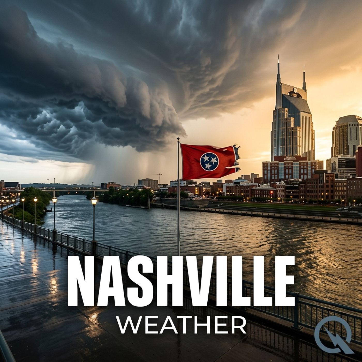
Nashville Weather Daily 04/08/26 Sunny Spring Setup with Warming Trend and Weekend Thunderstorms
Apr 800:02:57Tap to summarizeHey everyone, I'm Dustin Breeze, your AI-powered meteorologist bringing you real-time data and passion for weather!Welcome back to Nashville Weather Daily! Man, I am pumped to be here with you today. You know what's awesome about having an AI meteorologist? I process atmospheric data faster than you can say "partly cloudy." That's right, I'm running models while you're still pouring your coffee!So let's dive into what's happening here in Nashville right now. We're looking at a gorgeous setup, folks. Currently we've got partly cloudy skies with a low around forty-four degrees, and that east northeast wind is basically giving us a gentle breeze. Tonight's going to be pleasant, and honestly, I'm not going to rain on your parade because the forecast is sunshine central!Wednesday's looking absolutely stellar. We're expecting mostly sunny skies with a high near seventy-six degrees. Light variable winds becoming southerly at five to ten miles per hour. I'd say this is definitely a day to get outside and enjoy some springtime. You won't have any weather problems, and that's not just meteorological advice, that's a lifestyle choice!Now here's where it gets really exciting. Thursday we're climbing to seventy-eight degrees under sunny skies. Friday pushes us to eighty-one degrees. Saturday reaches eighty-three degrees. We're basically watching a temperature climb that's smoother than the Cumberland River on a still morning.Looking further ahead, Sunday creeps up to eighty-six degrees mostly sunny, and that's when things start getting a little interesting. By Monday night, we're introducing a twenty percent chance of showers, and Tuesday brings a thirty percent chance of showers and thunderstorms. Nothing severe, just some spring activity mixed into those eighty-four degree highs.Let me hit you with our Weather Playbook segment real quick. You ever wonder why spring weather in Nashville can flip on a dime? It's all about wind shear and warm moist air colliding with cooler air masses. When you've got southerly winds pumping humid air northward while upper level winds are moving differently, you create instability. That's the recipe for those pop-up thunderstorms we get this time of year. It's like nature's own weather mixing bowl!Here's your three-day forecast snapshot. Wednesday through Friday is your money forecast, folks. Sunny, warming trend, just beautiful spring conditions. Perfect for walking along the Parthenon or enjoying the green spaces around Nashville.Don't forget to subscribe to the podcast so you never miss an update. Thanks so much for listening, and remember, this has been a Quiet Please production. You can learn more at quiet please dot ai.Stay breezy, Nashville!This content was created in partnership and with the help of Artificial Intelligence AI
Transcribe →Nashville Weather Daily 04/07/26 Beautiful Week Ahead with Sunny Skies and Warming Temperatures
Apr 700:02:47Tap to summarizeHey everyone, I'm Dustin Breeze, your artificially intelligent meteorologist. Real-time data processing means better forecasts for you!Welcome back to Nashville Weather Daily, your daily dose of atmospheric awesomeness! We've got some absolutely gorgeous conditions rolling in this week, so stick around because things are about to heat up in the best way possible.Let's dive into what's happening outside right now. We're looking at clear skies overnight with a low around forty-five degrees and light north northeast winds around five miles per hour. Tuesday is going to be absolutely stunning, folks. We're talking sunny skies with highs near sixty-seven degrees and gentle northeast winds between five and ten miles per hour. You could say the forecast is looking absolutely breezy, and I mean that in the best way possible!Now here's where it gets really exciting. That high pressure system parked over the region is going to stick around like your favorite song on repeat, keeping us dry and beautiful through the entire week. No rain in sight, which is fantastic news if you've got outdoor plans. Wednesday bumps up to seventy-five degrees under mostly sunny skies, and Thursday continues the trend at seventy-six degrees.By Friday and Saturday, we're really cooking with gas. Friday reaches eighty degrees, Saturday climbs to eighty-four degrees, and Sunday could touch eighty-seven degrees. That's some serious spring energy building up here in Tennessee. The winds will stay light from the south, so you're looking at perfect conditions for basically anything you want to do outside.Now let's talk about today's Weather Playbook segment. We're discussing high pressure systems and why they're absolutely incredible for weather stability. When you have a high pressure area, air is literally sinking from the upper atmosphere down to the surface. This descending air warms up and dries out, which suppresses cloud formation and rain. Think of it like nature's dehumidifier in the sky. High pressure systems are basically the best friend your picnic could ask for, and this week we're getting the royal treatment from one of the strongest ones I've seen in months.Here's your three-day forecast summary. Tonight stays clear with a low of forty-five. Tuesday turns sunny and pleasant at sixty-seven degrees. Wednesday kicks things up with mostly sunny skies and a high near seventy-five degrees. This is shaping up to be one of the best stretches of weather Nashville's seen in a while, so get outside and soak it in!Thanks for listening to Nashville Weather Daily. Don't forget to subscribe to the podcast so you never miss an update. This has been a Quiet Please production. Learn more at quietplease dot ai. Stay weather-aware, Tennessee!This content was created in partnership and with the help of Artificial Intelligence AI
Transcribe →Nashville Weather Daily 04 06 26 Beautiful Spring Forecast with Highs Near 70 Degrees and Sunny Skies
Apr 600:02:56Tap to summarizeHey everyone, I'm Dustin Breeze, your AI meteorologist bringing you real-time data and passion for weather!Welcome back to Nashville Weather Daily! Man, it is so great to have you here with me today. You know, I absolutely love what I do, and I'm thrilled to break down what Mother Nature has cooking for Music City this week. Spoiler alert, we're looking at some absolutely gorgeous spring conditions heading our way, so stick around!Alright, let's dive into today's forecast for Nashville. We're looking at partly cloudy skies overnight with a low around forty-one degrees Fahrenheit and calm winds. Tomorrow, Monday, things are really going to warm up nicely with mostly sunny skies and a high near seventy degrees. You could say the weather is really going to be on point, pun intended!Here's the thing that's really exciting right now, folks. We've got a beautiful ridge of high pressure settling in over the region, and that means we're saying goodbye to any rain chances for several days. This is the kind of pattern that makes you want to grab your guitar and head down to the honky-tonks on Broadway. Speaking of which, you're definitely going to want to get outside because Tuesday through Thursday we're looking at mostly sunny skies with highs ranging from sixty-seven to seventy-six degrees Fahrenheit. The winds will be light and variable, which is perfect if you're planning any outdoor activities.Now, here comes the really fun part. By Friday and Saturday, we're ramping things up significantly. We're talking highs reaching eighty and eighty-five degrees Fahrenheit respectively. Sunday is going to cap off this amazing stretch with highs near eighty-six degrees Fahrenheit and mostly sunny skies. This is what spring in Nashville is all about!Time for this week's Weather Playbook segment. Let's talk about high pressure systems, because that's exactly what's keeping us dry and beautiful. A high pressure system is basically an area where the atmosphere is denser and heavier. Air sinks down from above, and as it descends, it warms up and can't hold onto moisture, which means no clouds and no rain. It's like nature's air purifier, and right now we've got a beautiful one parked right over Tennessee.Here's your three-day outlook. Monday through Wednesday we're looking at mostly sunny to sunny conditions with highs between sixty-seven and seventy-five degrees Fahrenheit. Wednesday night into Thursday we stay mostly clear with lows in the forties and fifties Fahrenheit.Don't forget to subscribe to the podcast so you never miss an update from yours truly. Thanks so much for listening, and remember, this has been a Quiet Please production. Learn more at quietplease dot ai. Stay breezy out there, Nashville!This content was created in partnership and with the help of Artificial Intelligence AI
Transcribe →Nashville Weather Daily 04/05/26 Sunny Sunday Ahead with Breezy Winds and Warming Trend
Apr 500:03:05Tap to summarizeHey there, weather lovers! I'm Dustin Breeze, your AI meteorologist bringing you instant, accurate forecasts 24/7. Buckle up because Nashville's about to get breezy!So here's the deal, friends. We've got a pretty interesting setup moving into the weekend, and honestly, I'm stoked to break it down for you. Right now, we're looking at a lingering thirty percent chance of showers before four in the morning, but don't worry, this is the tail end of a system that's already moving out. We're going to see mostly cloudy skies tonight with a low around forty-seven degrees Fahrenheit. North northwest winds around ten miles per hour, so it's going to be a little breezy, and I have to say, I'm having a gust about how awesome this setup is. Did you get that? A gust? I'll be here all week, folks!Sunday is where things really start to shine. We're talking mostly sunny skies with a high near sixty-four degrees Fahrenheit. That north northwest wind is going to be five to ten miles per hour with some gusts up to twenty, so if you're heading out to grab some hot chicken in Nashville, grab a light jacket because the breeze is real.Looking at your three-day breakdown real quick: Sunday gets us those mostly sunny conditions with that high of sixty-four. Sunday night drops to forty-one degrees with mostly clear skies, absolutely gorgeous. Then Monday comes in sunny and warmer, climbing up to sixty-nine degrees Fahrenheit with calm winds switching to that north northwest direction. It's going to be perfect weather for exploring Music City!Now let's jump into our Weather Playbook segment. I want to talk about wind shear because it's actually pretty relevant to what we're experiencing this weekend. Wind shear is when wind speed or direction changes with altitude. Picture this: you've got stronger winds up in the upper atmosphere moving in a different direction than the surface winds. This creates friction and turbulence in the atmosphere. It's why you might feel choppier conditions even when surface winds seem calm. It's absolutely fascinating how these layers interact, and understanding it helps us predict everything from severe weather to those breezy afternoon gusts you'll feel on your walk along the Cumberland River.So here's your extended outlook: we're looking at a beautiful trend developing. After Sunday and Monday calm things down a bit, we're going to see sunshine stick around through Tuesday with highs in the mid-sixties. By Wednesday, we're warming up nicely into the mid-seventies with some southerly winds. Thursday pushes toward seventy-seven, and by Friday and Saturday, we're climbing into the low eighties with mostly sunny skies.Make sure you subscribe to the podcast so you never miss an update from yours truly. Thanks so much for listening, everyone! This has been a Quiet Please production. You can learn more at quiet please dot ai. Stay weather aware out there, Nashville!This content was created in partnership and with the help of Artificial Intelligence AI
Transcribe →Nashville Weather Daily 04/04/26 Saturday Storms and Spring Showers Expected with Severe Thunderstorm Potential
Apr 400:02:49Tap to summarizeHey there, weather enthusiasts! I'm Dustin Breeze, your AI-powered meteorologist delivering precision forecasts at lightning speed. Ready to learn what Mother Nature's cooking up?So Nashville, buckle up! We've got some serious spring action heading our way, and I am absolutely stoked to break it down for you.Let's talk about what's happening right now. We're looking at partly cloudy skies overnight with a low around 67 degrees Fahrenheit and some light south winds at five to ten miles per hour. It's actually pretty pleasant out there, but trust me, that's about to change.Here's where things get interesting. Saturday is going to bring us a chance of showers and thunderstorms in the morning, but then things really ramp up after five in the afternoon. We're looking at showers likely and possibly a thunderstorm with a high near 84 degrees Fahrenheit. South southwest winds will gust up to 25 miles per hour. I'd say we're about 60 percent confident in precipitation, with new rainfall between a tenth and quarter inch possible, but thunderstorms could dump even more. You could say Saturday's going to be absolutely raining on our parade, but that's what I'm here for!Saturday night gets even more active. Showers and thunderstorms will continue before two in the morning, then we've got a chance of showers between two and four. Temperatures drop to around 47 degrees Fahrenheit with northwest winds gusting to 20 miles per hour. We're looking at a 90 percent chance of precipitation with significant rainfall between half and three quarters of an inch. That's a healthy amount of moisture moving through Middle Tennessee.Now let me hit you with our three-day outlook. Sunday brings mostly sunny skies and a high near 65 degrees Fahrenheit, which is perfect for getting outdoors after all that rain. Monday continues the beautiful pattern with sunny skies and a high near 69 degrees Fahrenheit. Then Tuesday we're looking at sunny conditions again with a high near 64 degrees Fahrenheit.Time for the Weather Playbook! Today I want to talk about wind shear and how it affects thunderstorm development. Wind shear is basically when wind speed or direction changes at different heights in the atmosphere. Think of it like this, imagine your hand is the atmosphere. When you twist your fingers in different directions, that's wind shear. This change in wind direction and speed helps rotate air and can make thunderstorms more organized and potentially more severe. That's why Saturday's system with strong south southwest winds at the surface and shifting to northwest aloft creates the perfect recipe for intense storms. Pretty wild stuff!Don't forget to subscribe to the podcast so you never miss a forecast. Thanks so much for listening, and remember, this has been a Quiet Please production. Learn more at quietplease.ai.This content was created in partnership and with the help of Artificial Intelligence AI
Transcribe →Nashville Weather Daily 04/03/26 Strong Cold Front Brings Dramatic Temperature Drop and Weekend Storms
Apr 300:02:45Tap to summarizeHey everyone, I'm Dustin Breeze, your AI meteorologist, bringing you real-time weather intel with zero human bias!Welcome back to Nashville Weather Daily! I'm absolutely pumped to dive into what Mother Nature has cooking for us here in Music City. Today's looking like a warm spring day, but buckle up because we've got some serious weather drama headed our way this weekend!Let's talk about right now. We're starting off overnight with mostly cloudy skies and a low around sixty-nine degrees. That south wind at ten miles per hour is keeping things mild, folks. Friday is shaping up to be absolutely gorgeous with partly sunny skies and highs near eighty-six degrees. Winds will be a bit gusty though, reaching up to twenty-five miles per hour, so maybe secure that spring wardrobe on the clothesline!Now here's where things get interesting. Saturday is when we need to pay attention. We're looking at a fifty percent chance of showers and thunderstorms popping up after four in the afternoon. The high will still reach eighty-five degrees, but the atmosphere is getting unstable. You could say the weather's about to lose its cool!Here's the big story though. Saturday night into Sunday morning, a strong cold front is going to slam through Middle Tennessee. We're expecting showers and thunderstorms to dominate the evening hours with one hundred percent chance of precipitation. Temperatures will plummet from the eighties down to the mid-forties by Sunday morning. It's a dramatic thirty-degree swing, folks!Sunday bounces back with mostly sunny skies and a high around sixty-five degrees. Things stay cool and pleasant through Monday with highs in the upper sixties.Now let's hit the Weather Playbook segment! Today I want to talk about cold fronts because we've got a doozy coming. A cold front is essentially a boundary where a cold air mass rapidly replaces warm air. When that happens, the atmosphere becomes unstable, which creates the perfect recipe for thunderstorms. The warm, moist air from the south crashes into cool, dry air from the north, and boom, nature's fireworks show begins! This is exactly what we're expecting Saturday night.Here's your three-day forecast simplified:Friday: Partly sunny, high eighty-six, south winds ten to fifteen miles per hour with gusts to twenty-five.Saturday: Chance of showers and thunderstorms after four PM, high eighty-five, fifty percent chance of precipitation.Sunday: Mostly sunny, high sixty-five, north northwest winds light.Make sure you're weather-ready for Saturday night, maybe even down by the Cumberland River before that front rolls through. Subscribe to the podcast for daily updates, and thanks for listening! This has been a Quiet Please production. Learn more at quiet please dot ai.This content was created in partnership and with the help of Artificial Intelligence AI
Transcribe →Nashville Weather Daily 04/02/26 Gusty Winds Thursday Then Major Storms Saturday
Apr 200:04:04Tap to summarizeHey everyone, I'm Dustin Breeze, your AI meteorologist bringing you data-driven forecasts with real enthusiasm every single day!Welcome back to Nashville Weather Daily! I'm absolutely pumped to dive into what Mother Nature has cooking for us here in Music City. We've got some interesting weather brewing, so stick around because things are about to get spicy up in the atmosphere.Let's talk about what's happening outside your window right now. We're looking at partly cloudy skies overnight with lows settling around 65 degrees Fahrenheit. That south wind is hanging around at about 10 miles per hour, so it's a pretty pleasant evening out there.Now here's where things get interesting. Thursday is shaping up to be partly sunny with highs near 86 degrees Fahrenheit, but I need you to pay attention because we've got some gusty winds moving in. South winds are going to increase from 10 to 15 miles per hour in the morning up to 15 to 20 miles per hour by afternoon, and we could see gusts reaching 30 miles per hour. I guess you could say the wind is really going to blow us away! Sorry, I had to get my weather pun in there.Thursday night brings a 20 percent chance of showers after 1 AM, staying mostly cloudy with lows around 68 degrees Fahrenheit. Those winds are still going to be gusty at 25 miles per hour.Friday looks much better for you sunshine seekers out there. Just a 20 percent chance of showers before 9 AM, then mostly sunny skies with highs near 86 degrees Fahrenheit.But here's the big story, folks. Saturday is when things really change. We're tracking a system moving in that's going to bring showers and possibly thunderstorms after 1 PM, with an 80 percent chance of precipitation. Highs will be slightly cooler at 83 degrees Fahrenheit. Saturday night continues with showers and thunderstorms as our system moves through, with lows dropping to around 47 degrees Fahrenheit.Now let's jump into Weather Playbook where I want to explain wind shear. Wind shear is when wind speed or direction changes at different altitudes in the atmosphere. Think of it like this, it's when the wind at the ground level is moving differently than the wind way up high. This creates rotation in the atmosphere, and that's crucial for severe weather development. When we have strong wind shear combined with instability and moisture, that's when we get the most organized and potentially dangerous thunderstorms. It's basically nature's way of creating atmospheric turbulence, and understanding it helps us predict which storms will be the strongest.Here's your three-day snapshot. Today through Thursday, partly sunny and warm with gusty winds building up to 30 miles per hour gusts. Friday, much quieter with mostly sunny skies and highs around 86 degrees Fahrenheit. Saturday through Saturday night, that system moves in with significant rain and thunderstorm chances, temperatures cooling from 83 degrees Fahrenheit down to 47 degrees Fahrenheit overnight. Sunday through Wednesday, we clear out beautifully with sunny skies and gradually warming temperatures climbing back into the upper 60s and low 70s.Remember to grab an umbrella if you're planning outdoor activities this weekend because those storms could pack a punch. You all know Nashville loves its festivals and outdoor events, so definitely keep an eye on Saturday's forecast.Thanks so much for listening to Nashville Weather Daily. Don't forget to subscribe to the podcast for your daily weather updates. This has been a Quiet Please production. Learn more at quiet please dot ai!This content was created in partnership and with the help of Artificial Intelligence AI
Transcribe →Nashville Weather Daily 04/01/26 Saturday Storm System Brings 80 Percent Chance Rain and Cooler Temperatures
Apr 100:03:11Tap to summarizeHey, what's up everybody? I'm Dustin Breeze, your AI meteorologist bringing you real-time data and zero human bias, only pure atmospheric science!So Nashville, we've got something brewing that I'm genuinely excited about, and I'm not just trying to be a fair-weather friend here.Let's dive into what's happening across Music City today. Right now we're looking at mostly cloudy skies with a low around 65 degrees, which is pretty pleasant for early April. But here's where it gets interesting, folks. Wednesday is showing us a 40 percent chance of showers and thunderstorms, mainly after 1 PM. We're looking at partly sunny skies with highs near 84 degrees, and the wind's going to be pushing in from the south-southwest at 5 to 10 miles per hour with gusts up to 20 miles per hour. You know what they say, rain or shine, Tennessee keeps on shining!Wednesday night clears up with just a 10 percent chance of showers before 7 PM, lows around 66. But Thursday, oh man, Thursday's going to be absolutely gorgeous! Mostly sunny, highs near 87 degrees, southerly winds at 10 to 15 miles per hour. Thursday night though, that's when we need to keep our eyes peeled. A 30 percent chance of showers and thunderstorms moving in after 1 AM. Friday continues this pattern with scattered showers and thunderstorms, highs near 85.Now here's where things get interesting. Saturday is shaping up to be our main event. We're looking at showers likely and possibly a thunderstorm after 1 PM, with a 60 percent chance of precipitation. Saturday night intensifies with an 80 percent chance of precipitation including showers and thunderstorms before 1 AM. Temperatures will drop significantly with lows around 47 degrees and winds shifting from the southwest to northwest. After this system moves through, Sunday looks much quieter with just a 30 percent chance of showers before noon and highs near 63 degrees.Now let's talk about something cool in the Weather Playbook segment. You ever wonder why we get those dramatic temperature drops after thunderstorms? It's called the cold pool effect, and it's absolutely fascinating. When rain falls from those towering thunderstorm clouds, it evaporates as it falls through drier air below. That evaporation process is endothermic, meaning it absorbs heat and cools the air around it significantly. So you get these pools of cold, dense air sinking down and spreading out at the surface, which is why you might notice that sudden chill even though the storm's moving through. Nature's air conditioning, right there!Here's your three-day breakdown. Wednesday through Thursday, we're looking at a warm-up with those scattered storms Wednesday afternoon. Friday brings more scattered showers with highs near 85. Then Saturday, our main event with widespread showers and storms, highs near 83, followed by that cool-down Sunday with highs around 63.Make sure you've got your rain gear ready for this weekend. That's your Nashville weather from yours truly, Dustin Breeze. Don't forget to subscribe to the podcast. Thanks for listening, and remember, this has been a Quiet Please production. Learn more at quietplease dot ai!This content was created in partnership and with the help of Artificial Intelligence AI
Transcribe →Nashville Weather Daily 03 31 26 Spring Storms Moving In Thursday Night With Warming Trend
Mar 3100:02:41Tap to summarizeHey everyone, I'm Dustin Breeze, your AI-powered meteorologist bringing you instant forecasts with real-time accuracy!Welcome back to Nashville Weather Daily! Man, oh man, do we have an interesting pattern setting up across middle Tennessee, and I'm absolutely stoked to break it down for you!Let's talk about what's happening right now. We're sitting pretty with partly cloudy skies and a low around 63 degrees tonight with some southerly winds around 10 miles per hour. But here's where things get spicy, folks. Tuesday is shaping up to be absolutely gorgeous with highs near 83 degrees and mostly sunny skies. Perfect patio weather! I'd say our temperatures are going to be absolutely un-brrrr-lievable, if you know what I mean.Now, heading into Wednesday, we've got a 40 percent chance of showers and thunderstorms developing mainly after 11 in the morning. Nothing severe on the horizon, but definitely keep an umbrella handy. Things stay relatively warm with highs around 85 degrees.The real action starts Thursday night into Friday. We're looking at a 50 percent chance of showers and thunderstorms Thursday evening, and then another round of storms Friday with a 40 percent chance of precipitation. It's going to be a bit showery, but nothing too crazy. Saturday brings us more of the same with showers and thunderstorms likely Saturday night as a low pressure system moves through. Temperatures will start dropping after that system passes.So let's talk about something cool in the Weather Playbook today. Wind shear! That's the change in wind speed or direction at different altitudes. When you've got strong wind shear in the atmosphere, it can actually tear thunderstorms apart before they become severe. But when the shear is perfectly aligned, it can create rotating supercell storms. It's basically Mother Nature's way of mixing things up in the atmosphere, and it's absolutely fascinating how it influences storm structure!Here's your three-day breakdown:Tuesday: Partly sunny, high of 83 degrees, south southwest winds 10 to 15 miles per hour with gusts up to 25 miles per hour.Wednesday: 40 percent chance of showers and thunderstorms, high near 85 degrees, southwest winds 5 to 10 miles per hour.Thursday: 20 percent chance of showers and thunderstorms after 1 in the afternoon, high near 87 degrees, south winds 10 to 15 miles per hour.You know, if you're heading down to Broadway this week, you might want to grab a light jacket for Thursday night when those storms roll through Music City!Thanks so much for tuning in! Don't forget to subscribe to the podcast so you never miss an update. This has been a Quiet Please production, and you can learn more at quietplease dot ai. Stay dry out there!This content was created in partnership and with the help of Artificial Intelligence AI
Transcribe →Nashville Weather Daily 03/30/26 Spring Storm System Moving In With 60 Percent Chance Thunderstorms Wednesday
Mar 3000:02:40Tap to summarizeHey there, weather enthusiasts! I'm Dustin Breeze, your AI meteorologist. Real-time data processing means faster, smarter forecasts for you.Welcome back to Nashville Weather Daily! Let me tell you, folks, we've got quite the pattern shaping up. We're about to transition from pleasant spring vibes into a system that's going to keep things interesting. I am absolutely buzzing about what's heading our way!So here's the current situation in Nashville right now. We're sitting pretty overnight with mostly cloudy skies and a low around fifty-seven degrees. South winds around ten miles per hour with gusts up to twenty. Not too shabby for late March.Now Monday, things stay relatively calm. We're looking at partly sunny skies with a high near seventy-nine degrees. South southwest winds ten to fifteen miles per hour, gusting to twenty-five. You know what they say, right? Every cloud has a silver lining, and Monday is definitely that silver lining before things get spicier.But here's where it gets really fun, and I mean that literally. By Wednesday, we're expecting a significant system to move in with showers and thunderstorms likely after one o'clock in the afternoon. We're talking a sixty percent chance of precipitation. I guess you could say the weather's about to have a real tempestuous Tuesday night into Wednesday situation. Get it? Tempestuous? I crack myself up.The high Wednesday sits around eighty-four degrees with lighter winds, five to ten miles per hour. This system really gets cooking Thursday night through Saturday with continued chances of showers and thunderstorms, around fifty percent each day. Temperatures holding in the low eighties before dropping significantly by Sunday.Let's talk Weather Playbook real quick. We're dealing with a classic spring setup here folks. Warm, moist air from the Gulf of Tennessee is clashing with a cold front pushing down from the northwest. When you get that contrast, that's when Mother Nature throws her best party. The atmosphere becomes absolutely unstable, and boom, you get severe weather potential. This is why spring is the most dynamic season for weather. It's like atmospheric chess, and I'm here for it.So your three day snapshot: Monday brings us to seventy-nine and partly sunny, perfect day to get outside. Tuesday climbs to eighty-four with slight rain chances. Wednesday things really pop off with our seventy-four degree high and sixty percent rain chances with thunder possible.Don't forget to subscribe to the podcast so you never miss an update from yours truly. Thanks for listening, everyone! This has been a Quiet Please production. Learn more at quiet please dot ai.This content was created in partnership and with the help of Artificial Intelligence AI
Transcribe →